Whether you want to query data in snowflake, view data in our platform, export data, locate diagrams, or download well logs, we have got you covered.
1. Headers
Snowflake
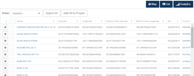
Location data in the headers tables are available to query in snowflake.
Export
The headers export provides comprehensive information about a well, including its location data.
List View
Choose:
![]() in the
in the ![]() view. To access the latitude and longitude coordinates for the surface or bottom hole, click here for information on how to add columns.
view. To access the latitude and longitude coordinates for the surface or bottom hole, click here for information on how to add columns.
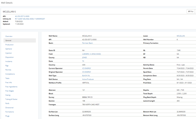
Well Details: General Tab
2. Directional Survey
Snowflake
Directional survey tables are available to query in snowflake.
Export Data
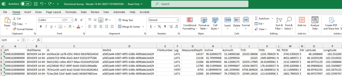
Export the data points of the directional survey to Excel or CSV using the Data Export Wizard.
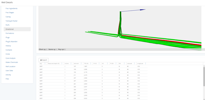
Well Detail: Directional Tab
A diagram of the directional survey is available in the Well Details. Within the well details directional tab, there is also a table that can be exported, providing all the valuable information obtained from the directional survey. For more details about directional surveys
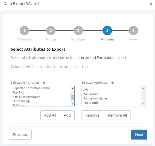
3. Interpreted Formations
Available with our plus, pro, and enterprise level subscriptions, the interpreted formations will provide more details on the depths, tops, and more.
Snowflake
Interpreted formation tables are available to query in snowflake.
Export Data
The interpreted formations are available to export with our advanced exports.
From the list, choose ![]() or
or ![]() to open the data export wizard and choose the attributes you would like to receive.
to open the data export wizard and choose the attributes you would like to receive.
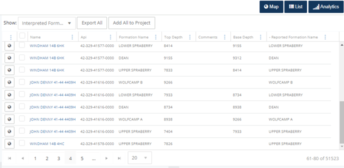
List View
Choose:
![]() in the
in the ![]() view.
view.
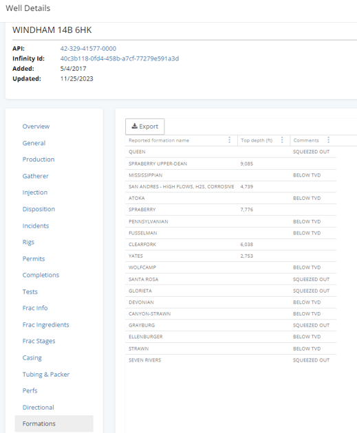
Well Detail Card: Formations Tab
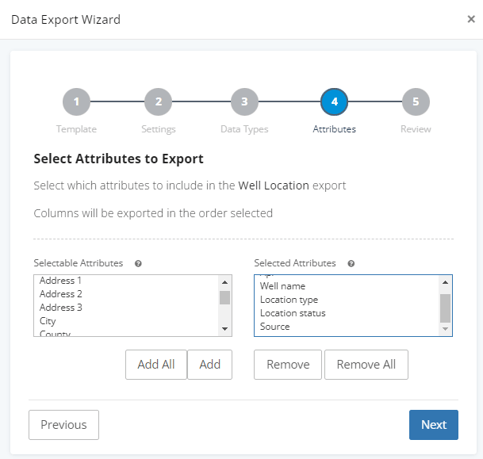
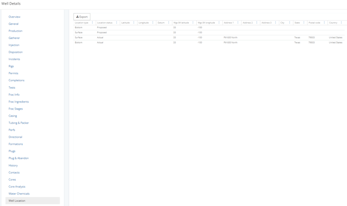
4. Well Location
Available information includes: Address, city, state, postal code, section, township and range (or abstract and survey), footages, location type (bottom or surface), location status (actual or proposed), source, and more.
Snowflake
Well location tables are available to query in snowflake.
Export
Step through the Data Export Wizard to select the desired attributes for the well location.
List View
Choose:
![]() in the
in the ![]() view.
view.
Well Details: Well Location Tab
4. Tif/LAS logs
We provide access to publicly available well logs. You can locate these logs in the files tab of the well detail card for viewing or downloading individual documents. However, if you need to download multiple logs, you can navigate to tools> document finder.