Your ZIP file will contain multiple files that make up a single shape layer. However, often times when shapefiles are received, multiple shapes are included in a single ZIP.
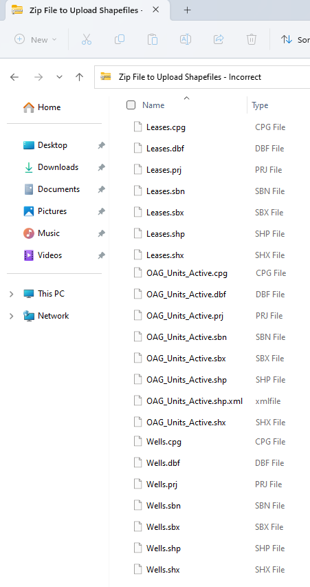
Incorrect ZIP File
In the example shown below we have shapes for: Leases, Units, and Wells. Attempting to upload all three shapes in a single ZIP file will fail.
Correct ZIP File
Let's split out just the Active Units into one file, then the same process would need to be followed for the leases into another, and wells into a third. The easiest way to accomplish this is to make a copy of the entire zip file, and then delete the additional files.
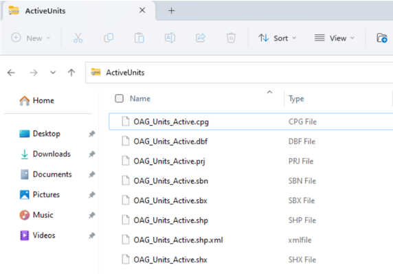
Once you have 3 separate ZIP files created from the initial file, you will be able to upload each of these as a shape. Then you can show all three shape layers on your WellDatabase map.
File Names MUST Match
Make sure that each shapefile in the ZIP file has an identical file name, with only the file extensions being different. This will ensure that the upload process goes smoothly and that all the shapes are correctly displayed on your WellDatabase map.
Unsupported Shapefiles
Some shapefiles that are very large or complex may not be able to be uploaded into WellDatabase due to browser size limitations. Each browser has different limits on the size of files they can handle. For example, Chrome has a memory limit of 2gb per tab to prevent the browser from crashing. If you encounter difficulties uploading a shapefile in Chrome, you can try using a different browser like Firefox.
If the size of the shapefile, as well as the other layers and base map being used in WellDatabase, exceeds the limitations of your browser, unfortunately we are unable to offer further support for these large or complex shapefiles.
Alternatively, here are a few additional options that can help you work with the shapes you need:
- Split the shapefile into smaller files for different areas
- Remove some of the data points associated with each shape to reduce its size
- Try loading without the .dbf file
Upload a Shapefile in Your WellDatabase Account
For reference purposes, here is an article that will walk you thought how to upload a shapefile if you haven't done this before: Can I add a shapefile to my map?
Here is a link for Texas shapefiles: https://www.glo.texas.gov/land/land-management/gis/index.html which can be downloaded to your local computer, then uploaded into WellDatabase.
The ability to import your own shapefiles to WellDatabase, gives you unlimited possibilities for your map!