![WellDatabase-Rect-1000x159-1.png]](https://support.welldatabase.com/hs-fs/hubfs/WellDatabase-Rect-1000x159-1.png?height=40&name=WellDatabase-Rect-1000x159-1.png)
How to Access Well Details
Well Details brings together available information and records for an individual well, organized into tabs for easy navigation.
You can access Well Details from several locations throughout WellDatabase. Two of the most common are:
• From the Map, select a well spot and choose the option to open Well Details.
• From the List, select the well name to open Well Details directly.
Available tabs and data may vary depending on the records available for the well and your WellDatabase plan.
Note: The Lite (free) plan includes access to 50 unique well detail cards each month. Paid plans include unlimited well detail views.
Overview
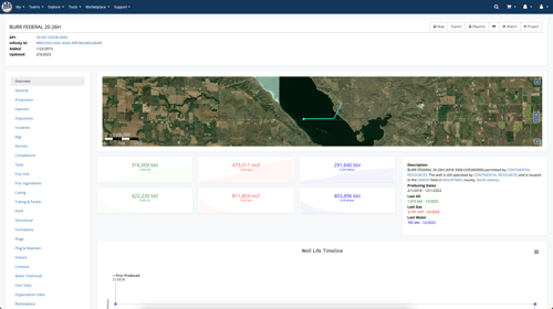
The Overview tab provides a high-level summary of the well, including:
-
Well location and satellite view.
-
Cumulative production volumes.
-
Producing dates.
-
Operator information.
-
A timeline of well activity.
The Overview tab is useful for quickly reviewing key information about a well before exploring the more detailed record tabs.
General
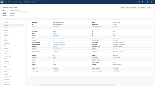
The General tab provides detailed well header information, including:
-
Well name and API/UWI.
-
Lease and well number.
-
Operator information.
-
Well status and type.
-
Field, county, state, and basin.
-
Formation information.
-
Activity and permit dates.
-
Depths and lateral length.
-
Surface and bottom-hole locations.
For more information about well header data, see What data is included in Header records?
Production Data
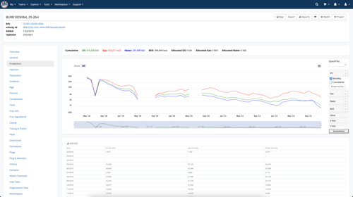
The Production tab displays available production data for the well in both chart and table formats.
From the production chart, you can review production over time and create a decline curve for the individual well.
For more information:
- See What data is contained in Production Records? for details about the production data fields available in WellDatabase.
- See What can I do on the production charts? for additional chart options and tools.
Gatherer Data
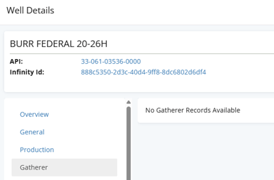
The Gatherer tab displays available gatherer records associated with the well. If no gatherer records are available, WellDatabase will display a message indicating that no records were found.
When gatherer data is available, the tab displays details such as the company, product, purchaser or gatherer designation, percentage, and applicable dates.

For more information about the data available in these records, see What data is contained in Gatherer Records?
Injection Data
The Injection tab displays available injection data for the well in both chart and table formats. The chart can include injection volumes, pressures, and permitted values over time.
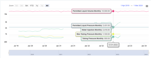
Below the chart, a table provides the underlying injection records and available data points.

For more information about the data available in these records, see What data is contained in Injection Records?
Disposition Data
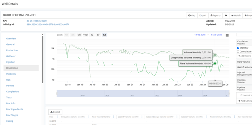
The Disposition tab displays available disposition data for the well in both chart and table formats. Disposition records can include volumes associated with:
- Oil transported by truck.
- Gas flared.
- Gas delivered to pipelines.
- Gas used on-site.
- Other reported disposition methods.
For more information about the data available in these records, see What data is contained in Disposition Records?
Incident Data
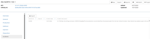
The Incidents tab displays available environmental incident records associated with the well. These records may include events such as leaks, blowouts, fires, spills, and other documented environmental incidents.
For more information about the data available in these records, see What data is contained in Environmental Incident Records?
Rig Data
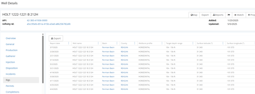
The Rigs tab displays available rig records associated with the well. These records can include:
- Report date.
- Basin and county.
- Wellbore profile.
- Target depth range.
- Surface location.
For more information about the data available in these records, see What data is contained in Rig Records?
Permit Data
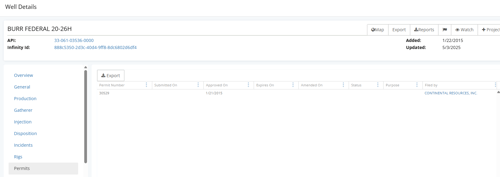
The Permits tab displays available permit records associated with the well. Permit information can include:
- Permit number.
- Submitted, approved, expiration, and amended dates.
- Permit status.
- Permit purpose.
- Operator or company associated with the permit.
For more information about the data available in these records, see What data is contained in Permit Records?
Completions Data
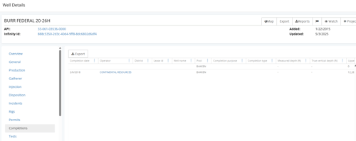
The Completions tab displays available completion records associated with the well. Completion information can include:
- Completion date.
- Operator and field.
- Completion purpose and type.
- Measured and true vertical depths.
- Perforation intervals.
- Additional completion details.
For more information about the data available in these records, see What data is contained in Completion Records?
Test Data
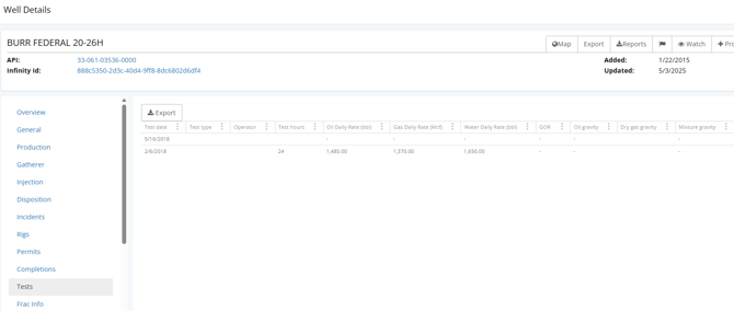
The Tests tab displays available test records associated with the well. Test information can include:
- Test date and duration.
- Daily oil, gas, and water rates.
- Oil and gas gravity.
- Pressures.
- Temperatures.
- Additional test measurements.
For more information about the data available in these records, see What data is contained in Test Records?
Frac Info
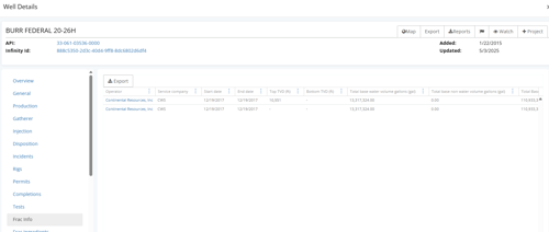
The Frac Info tab displays available hydraulic fracturing records associated with the well. Frac information can include:
- Operator and service company.
- Start and end dates.
- Top and bottom depths.
- Water and other fluid volumes.
- Proppant mass and material.
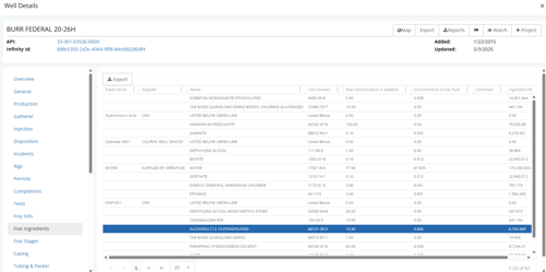
Frac Ingredients
The Frac Ingredients tab displays available information about the ingredients used during hydraulic fracturing operations, including:
- Ingredient or chemical name.
- Supplier or trade name.
- Purpose.
- Concentration or amount.
- Additional reported ingredient details.
For more information about the data available in these records, see What data is contained in Frac Ingredient Records?
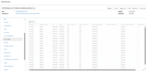
Frac Stages
The Frac Stages tab displays available information for individual hydraulic fracturing stages. Stage information can include:
- Stage date and number.
- Top and bottom depths.
- Fluid volumes.
- Proppant mass.
- Primary proppant material.
- Additional reported stage details.
For more information about the data available in these records, see What data is contained in Frac Stage Records?
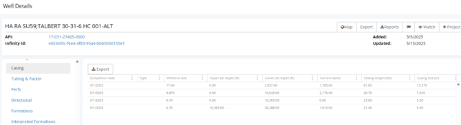
Casing
The Casing tab displays available casing records associated with the well. Casing information can include:
- Completion date.
- Casing type.
- Wellbore size.
- Upper and lower depths.
- Cement sacks.
- Casing weight and size.
For more information about the data available in these records, see What data is contained in Casing Records?
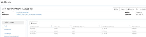
Tubing & Packer
The Tubing & Packer tab displays available tubing and packer records associated with the well. Information can include:
- Completion date.
- Tubing size.
- Upper and lower tubing depths.
- Packer depth.
For more information about the data available in these records, see What data is contained in Tubing & Packer Records?
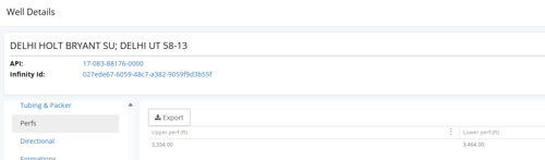
Perfs
The Perfs tab displays available perforation records associated with the well. Perforation information can include:
- Upper perforation depth.
- Lower perforation depth.
- Additional reported perforation details.
For more information about the data available in these records, see What data is contained in Perf Records?
Directional
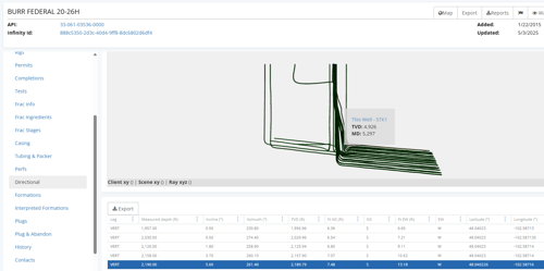
The Directional tab displays available directional survey data for the well. This includes a 3D visualization of the selected well and surrounding wellbores, along with a table containing the directional survey stations and available measurements.
For more information:
- See What data is contained in Directional Survey Records? for details about the available directional data fields.
- See How do I access directional survey data? for more information about viewing and working with directional survey data.
Formations
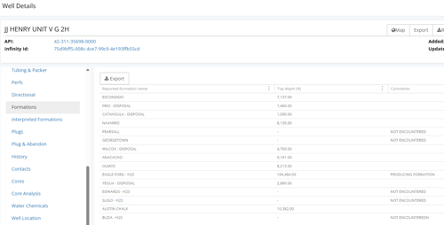
The Formations tab displays available reported formation records associated with the well. Formation information can include:
- Reported formation name.
- Formation top depth.
- Comments associated with the reported formation.
For more information about the data available in these records, see What data is contained in Formation Records?
Interpreted Formations
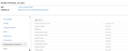
The Interpreted Formations tab displays available interpreted formation tops associated with the well, including the interpreted formation name and top depth.
For more information about the data available in these records, see What data is contained in Interpreted Formation Records?
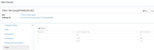
Plugs
The Plugs tab displays available plug records associated with the well. Plug information can include:
- Plug type.
- Lower plug depth.
- Amount of cement used.
For more information about the data available in these records, see What data is contained in Plug Records?
Plug & Abandon
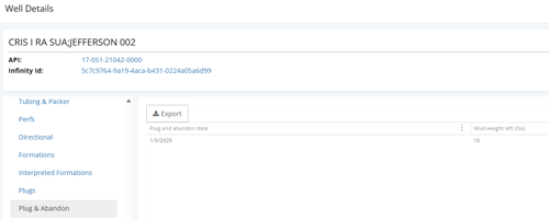
The Plug & Abandon tab displays available plugging and abandonment records associated with the well. Information can include:
- Plug and abandon date.
- Mud weight.
For more information about the data available in these records, see What data is contained in Plug & Abandon Records?
History
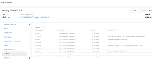
The History tab displays available historical records associated with the well. History information can include:
- Effective date.
- Operator.
- Field.
- Comments documenting historical well information.
For more information about the data available in these records, see What data is contained in History Records?
Cores
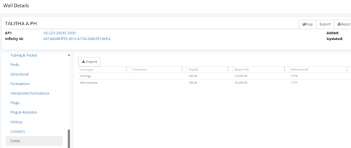
The Cores tab displays available core records associated with the well. Core information can include:
- Core type.
- Formation.
- Top and bottom depths.
- Reference ID.
- Comments associated with the core.
For more information about the data available in these records, see What data is contained in Core Records?
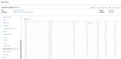
Water Chemicals
The Water Chemicals tab displays available water sample and chemical analysis data from the USGS water database. Information can include:
- USGS ID.
- Completion, sample, and analysis dates.
- Specific gravity.
- Chemical or constituent.
- Measurement units.
- Reported amounts.
For more information about the data available in these records, see What data is contained in Water Chemical Records?
Well Location
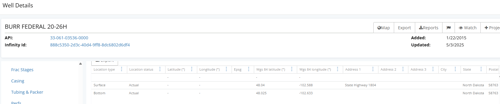
The Well Location tab displays available location records for the well, including coordinates as originally reported by the source. Location information can include:
- Location type, such as surface or bottom hole.
- Location status.
- Reported latitude and longitude.
- EPSG code identifying the coordinate reference system (CRS).
- WGS 84 latitude and longitude.
- Available address information, including city, state, and postal code.
WellDatabase uses EPSG:4326 / WGS 84 for standardized coordinates while also preserving the location information as originally reported.
For more information about the data available in these records, see What data is contained in Well Location Records?
Activity
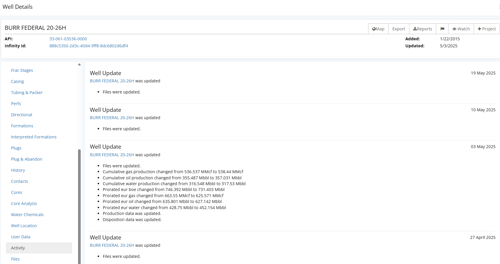
The Activity tab provides a timeline of updates associated with the well. Activity entries can show when changes were made to records such as:
- Files.
- Production data.
- Permits.
- Disposition data.
- Other well records.
This tab can be used to identify when information for a well was added or updated in WellDatabase.
Files
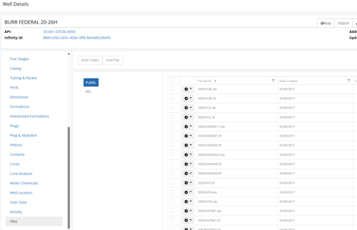
The Files tab contains publicly available documents associated with the well. Available file types can include TIFF, PDF, and LAS files.
Viewing and downloading documents requires a paid plan. Access to files and file-viewing tools varies by plan. For example, the built-in LAS Viewer is available with Plus and Pro plans.
For more information about working with files:
- Download files from a single well
- Download files in bulk from multiple wells
- Download files using an API request
- Viewing documents in WellDatabase
List View
In addition to viewing records for an individual well through Well Details, paid plans can view available record types for multiple wells directly from the List.
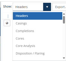
Use the Show dropdown to change from the default Headers view to another available record type, such as completions, casing, or disposition records.
Lite users can view the default Headers list. Viewing additional record types through the List requires a paid plan.
For more information about List features and functionality, see What can I do with a list? .
Subscription Requirements
Access to Well Details depends on your WellDatabase plan:
- Lite (free): View up to 50 unique well detail cards each month. Available views reset monthly.
- Essential: Unlimited well detail views.
- Plus: Unlimited well detail views.
- Pro: Unlimited well detail views.
Once a Lite user reaches the monthly limit, the “Well Detail Views are currently unavailable” message will appear when attempting to open another well detail card.
 Access to specific data, tools, and functionality within Well Details may vary by plan. See Compare Plans for current feature availability.
Frequently Asked Questions
Q: How many well detail cards can I view with Lite?
A: The Lite (free) plan includes access to 50 unique well detail cards each month. Available views reset monthly.
Q: What counts toward the 50 well detail card limit?
A: The limit is based on unique wells. Opening the same well multiple times during the same monthly cycle does not count as an additional well detail card.
Q: Why am I receiving an error message that says “Well Detail Views are currently unavailable”?
A: This message appears when a Lite user has reached the monthly limit of 50 unique well detail cards. Available views reset monthly, or you can upgrade to a paid plan for unlimited well detail views.
Q: Do paid plans have a well detail view limit?
A: No. Essential, Plus, and Pro include unlimited well detail views.
Q: Why don't I see all of the data types described in this article for every well?
A: Available data varies by well based on the records available from the source. Access to certain data types and functionality may also depend on your WellDatabase plan.
Q: Does having access to Well Details mean I can access every feature within the well detail page?
A: No. Access to specific data, tools, and functionality within Well Details varies by plan. See Compare Plans for current feature availability.
Explore additional articles by searching the topics on the left. If you have any questions, feel free to email support@welldatabase.com