![WellDatabase-Rect-1000x159-1.png]](https://support.welldatabase.com/hs-fs/hubfs/WellDatabase-Rect-1000x159-1.png?height=40&name=WellDatabase-Rect-1000x159-1.png)
How to Access Well Details
You can open Well Details from many places in WellDatabase. Two of the most common are:
- From the Map, select a well spot and choose the option to open Well Details.
- From the List, select the well name.
Well Details usually opens in a window over your map or list. To open it as a full page in a new tab, click the Open full page icon next to Close.
Note: Paid plans (Essential, Plus and Pro) open wells on the page described in this article. The Lite (free) plan opens wells on the classic page and includes 50 unique well detail cards each month. Here is a link to the Classic Page.
How the Page Is Organized
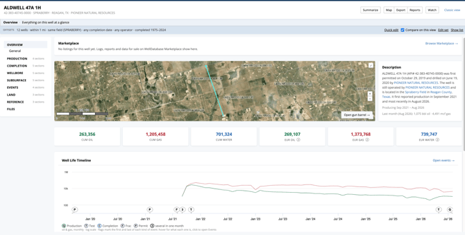
The header shows the well's name, its API, field, county, state and operator, and when the well was added to WellDatabase and last updated. Click the well name to return to Overview.
The rail on the left lists the well's groups: Overview, Production, Completion, Wellbore, Subsurface, Events, Land, Reference and Files. Click a group to open its view. The open group lists its record sections with the number of records in each; select a section to open its records table under the view.
The breadcrumb under the header shows where you are (for example, Overview / Production / Injection). Click any part of it to step back.
Private data. Your own data, such as User Data, team data or data sets, appears in a separate PRIVATE DATA card under the well's groups. Only you, and the members of each team or data set, can see it.
Header Actions
The buttons at the top right of the page work the same on every view:
- Summarize: Welly, the WellDatabase assistant, writes a summary of the well. See Summarize below.
- Map: Opens the map with this well.
- Export: Opens the export wizard with this well selected.
- Reports: Creates a report for the well, such as a Well Detail Report or a Scout Ticket.
- Watch: Adds the well to your watched wells. The button reads Watching while you watch the well; click it again to stop.
- Classic view: Opens the classic well detail page for this well.

Offsets
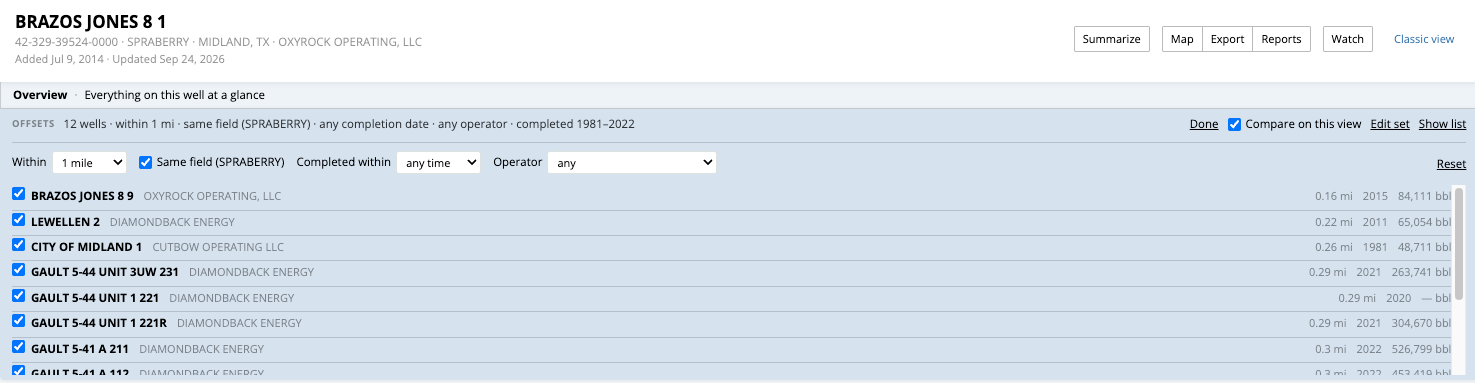
The OFFSETS bar sets the nearby wells this well is compared with. By default, these are the wells within 1 mile in the same field.
- Quick edit changes the distance (Within), Same field, Completed within and Operator, and lets you tick or untick individual wells.
- Compare on this view draws the offsets beside the well, for example on the production chart, in the completion design space and in the gun barrel.
- Edit set opens the full offset page, which adds lateral length, minimum 12-month cumulative oil and a neighbourhood map. Save as my default set applies the same rules on every well.
- Show list compares the well with the median of its offsets for cumulative oil and gas, first three months' oil and lateral length.
Click a well in any chart or drawing to pick it. It stays marked on every view, and the OFFSETS bar shows it with an Open button.
Overview
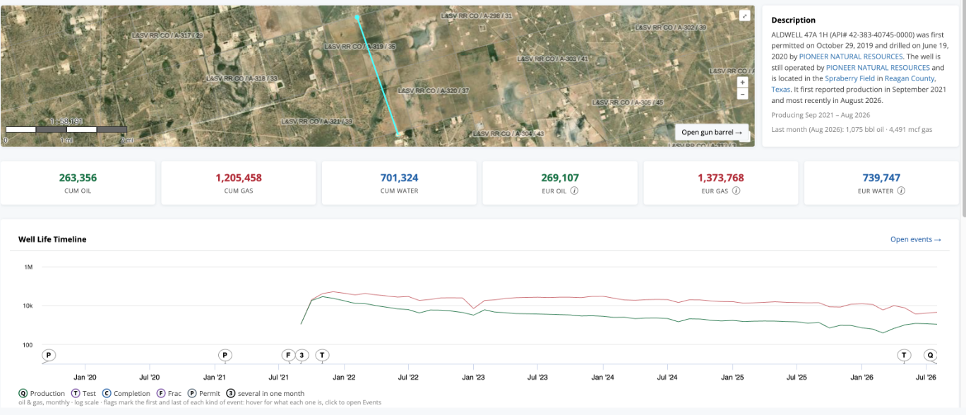
Overview is a high-level summary of the well:
- The well on the map, with its lateral. Open gun barrel → opens the gun barrel view in Subsurface.
- A written Description of the well, with its producing dates.
- Cumulative oil, gas and water, and the EUR (estimated ultimate recovery) for each. Where your plan includes it, the i beside an EUR explains how it was calculated, and See the fit → draws that forecast on the production chart.
- The Well Life Timeline: the production curve with permits, completions, fracs and tests flagged on it. Open events → opens the full timeline.
- General: the well's header record, including the well name and API/UWI, lease and well number, operator, well status and type, field, county, state and basin, formation, key dates, depths and lateral length, legal location, and surface and bottom-hole coordinates. Copy buttons sit beside the API, the coordinates and the well's IDs.
For more information about well header data, see What data is included in Header records?
Production
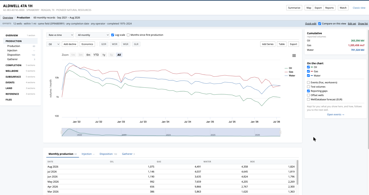
Production shows the well's volumes on one chart, with a monthly table under it.
- Plot Rate vs time, Rate vs cumulative or Cum vs cumulative, and use Display for a log scale.
- Add decline fits a decline curve to the stream you pick, and Economics opens economics for the well.
- Ratios adds GOR, WOR, WGR or GLR, and Add Series adds other streams.
- On the chart turns streams and overlays on and off, such as events, test volumes, offset wells and the WellDatabase forecast.
- Table switches to a table, and Export downloads the volumes.
Under the chart, tabs hold the records behind the view:
- Monthly production: the reported volumes month by month, with the well's allocated share where the lease reports one.
- Injection: injection volumes, pressures and permitted values over time.
- Disposition: volumes such as oil transported by truck, gas flared, gas delivered to pipelines, gas used on site and other reported disposition methods.
- Gatherer: the company, product, purchaser or gatherer designation, percentage and dates.
Click + Add to chart on an injection or disposition tab to draw those volumes on the main chart.
For more information, see What data is contained in Production Records?, What can I do on the production charts?, What data is contained in Injection Records?, What data is contained in Disposition Records? and What data is contained in Gatherer Records?
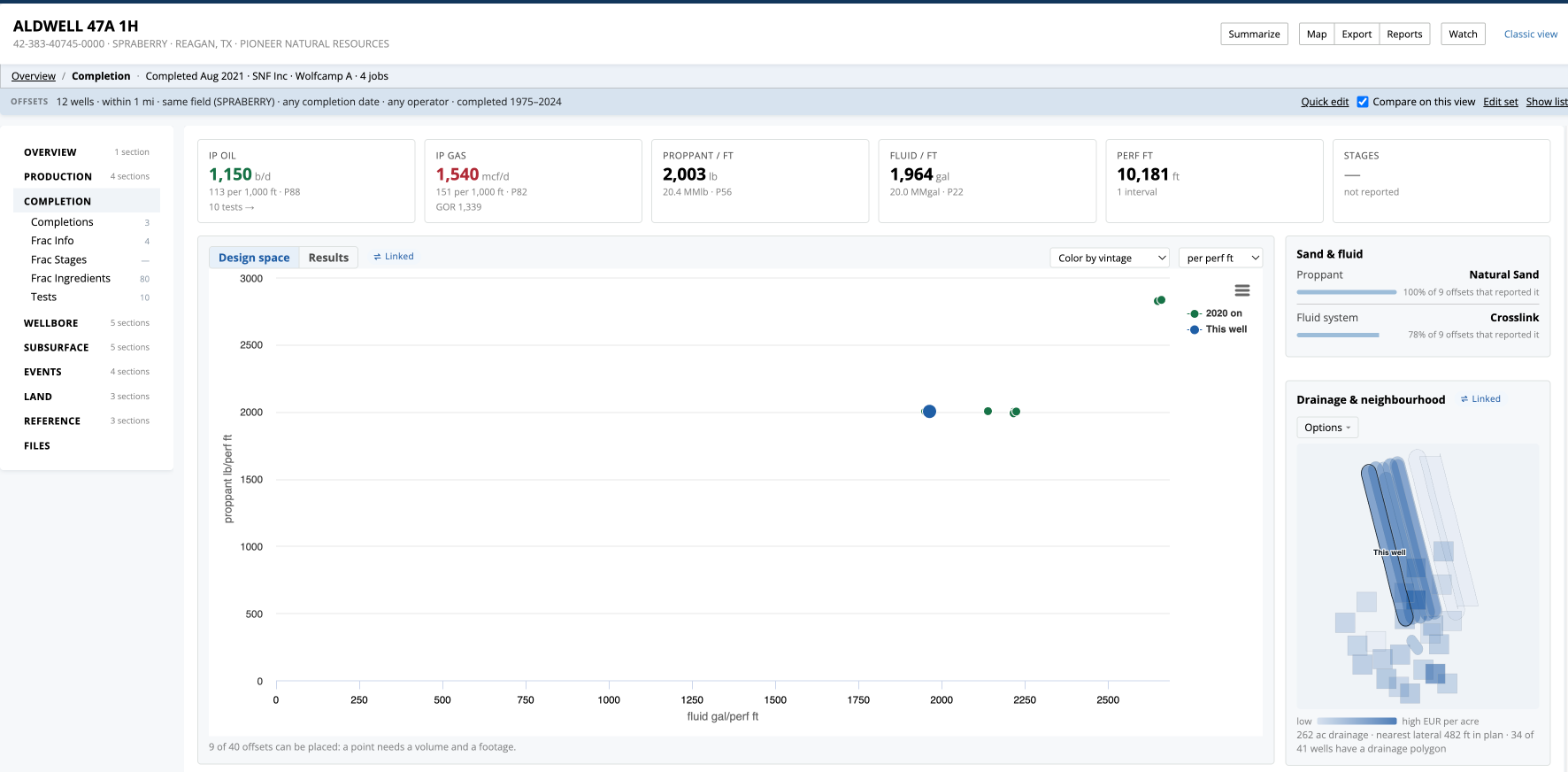
Completion
Completion shows how the well was completed and how its design compares with its offsets.
- Tiles across the top show IP oil, IP gas, Proppant / ft, Fluid / ft, Perf ft and Stages.
- Design space plots the well's design against its offsets; Options changes the coloring and normalization. Results plots initial rates against completion date instead.
- Sand & fluid breaks down what was pumped, and Drainage & neighbourhood shows the laterals around the well.
The record tabs under the view include:
- Completions: completion date, operator and field, completion purpose and type, measured and true vertical depths, perforation intervals and other completion details.
- Frac Info: operator and service company, start and end dates, top and bottom depths, water and other fluid volumes, and proppant mass and material.
- Frac Stages: stage date and number, top and bottom depths, fluid volumes, proppant mass and primary proppant material.
- Frac Ingredients: ingredient or chemical name, supplier or trade name, purpose, concentration or amount and other reported details.
- Tests: test date and duration, daily oil, gas and water rates, oil and gas gravity, pressures, temperatures and other test measurements.
- Perfs: upper and lower perforation depths and other reported perforation details.
For more information, see What data is contained in Completion Records?, What data is contained in Frac Stage Records?, What data is contained in Frac Ingredient Records?, What data is contained in Test Records? and What data is contained in Perf Records?
Wellbore
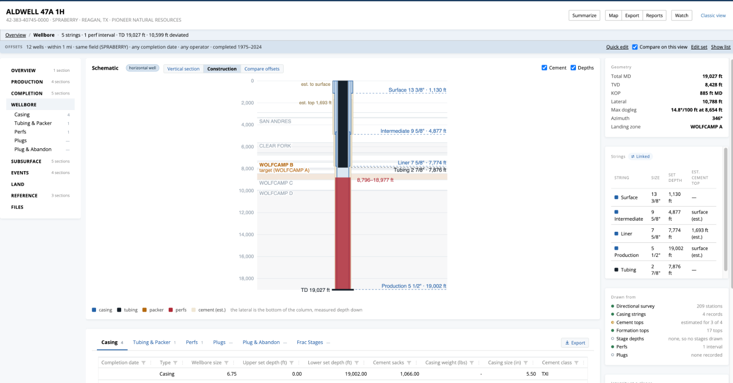
Wellbore draws a schematic of the well from its casing, tubing and perforation records: each string with its size and set depth, estimated cement tops, the formations beside it, and the well's geometry.
- Switch between Construction, Vertical section (for horizontal wells) and Compare offsets, which sets the well's casing beside its offsets'.
- Layers turns cement, depths and frac stages on and off, and switches between an exaggerated vertical scale and true scale.
- Integrity at a glance lists what the records show about the hole.
The record tabs under the view include:
- Casing: completion date, casing type, wellbore size, upper and lower depths, cement sacks, and casing weight and size.
- Tubing & Packer: completion date, tubing size, upper and lower tubing depths, and packer depth.
- Perfs and Frac Stages, so perforation and stage depths can be read against the casing.
- Plugs: plug type, lower plug depth and the amount of cement used.
- Plug & Abandon: plug and abandon date and mud weight.
For more information, see What data is contained in Casing Records?, What data is contained in Tubing & Packer Records?, What data is contained in Plug Records? and What data is contained in Plug & Abandon Records?
Subsurface
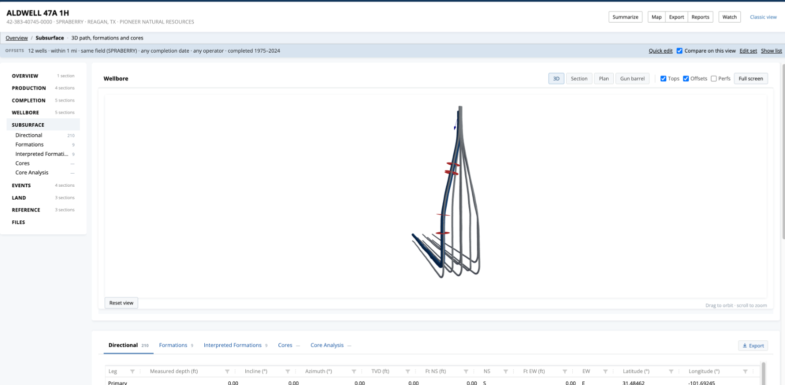
Subsurface shows the wellbore in 3D through the formation tops, with its offsets.
- 3D: drag to orbit and scroll to zoom.
- Section: true vertical depth against distance along the lateral.
- Plan: the laterals from above.
- Gun barrel: looking down the laterals, with the distance in feet from the well to each offset lateral, measured directly or across and down. Open gun barrel tool ↗ opens the full Gun Barrel Plot tool.
- Formation tops lists the reported and interpreted tops with their depths.
The record tabs under the view include:
- Directional: the directional survey stations and available measurements.
- Formations: reported formation name, top depth and comments.
- Interpreted Formations: interpreted formation name and top depth.
- Cores: core type, formation, top and bottom depths, reference ID and comments.
- Core Analysis: the analysis results reported for the well's cores.
For more information, see What data is contained in Directional Survey Records?, How do I access directional survey data?, What data is contained in Formation Records?, What data is contained in Interpreted Formation Records?, What data is contained in Core Records? and What data is contained in the Core Analysis Records?
Events
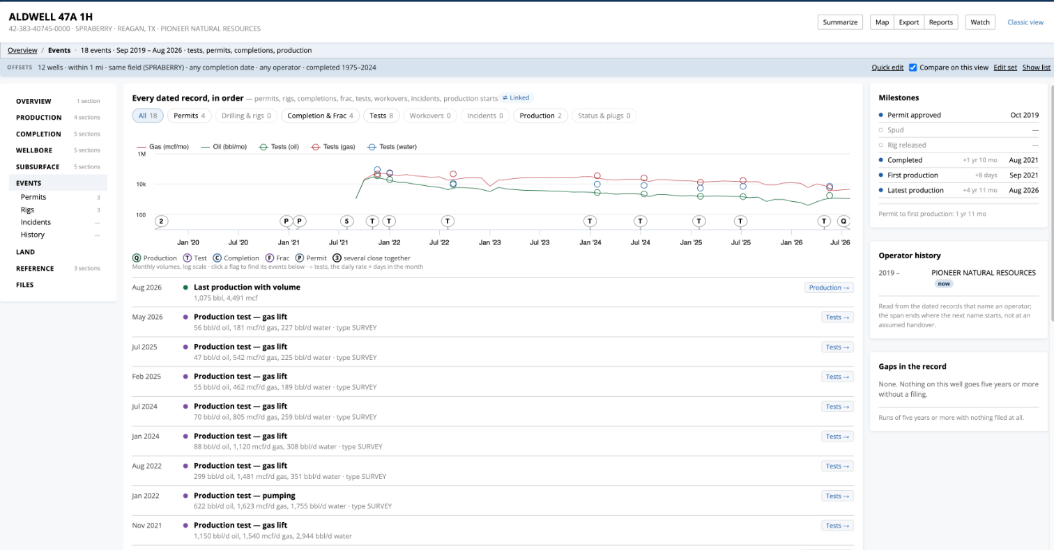
Events puts every dated record on the well in order on one timeline: permits, rigs, completions and fracs, tests, workovers, incidents, status changes and production starts, drawn over the monthly production curve.
- Use the buttons above the chart to show one kind of event, and click a flag to find it in the list. Each row's tag opens the record it came from.
- Milestones, Operator history and Gaps in the record sit beside the timeline.
The record tabs under the view include:
- Permits: permit number, submitted, approved, expiration and amended dates, permit status and purpose, and the operator or company.
- Rigs: report date, basin and county, wellbore profile, target depth range and surface location.
- Incidents: environmental incident records such as leaks, blowouts, fires and spills.
- History: effective date, operator, field and comments documenting the well's history.
- Activity: a timeline of updates to the well in WellDatabase, such as new files, production, permits or disposition data, so you can see when information was added or changed.
For more information, see What data is contained in Permit Records?, What data is contained in Rig Records?, What data is contained in Environmental Incident Records? and What data is contained in History Records?
Land
Where available, Land shows the appraisal / mineral roll recorded against the well on the county appraisal roll, such as gross acres, properties and owners.
Reference
Reference summarizes where the well is, who to contact and any water chemistry, with the full records in tabs:
- Well Location: location type (such as surface or bottom hole), location status, latitude and longitude as reported, the EPSG code for the reported coordinate reference system, standardized WGS 84 latitude and longitude, and any address information. WellDatabase standardizes coordinates to EPSG:4326 / WGS 84 while keeping the location as originally reported.
- Contacts: contacts recorded for the well.
- Water Chemicals: water sample and chemical analysis data from the USGS water database, including USGS ID, completion, sample and analysis dates, specific gravity, chemical or constituent, units and reported amounts.
For more information, see What data is contained in Well Location Records? and What data is contained in Water Chemical Records?
Files
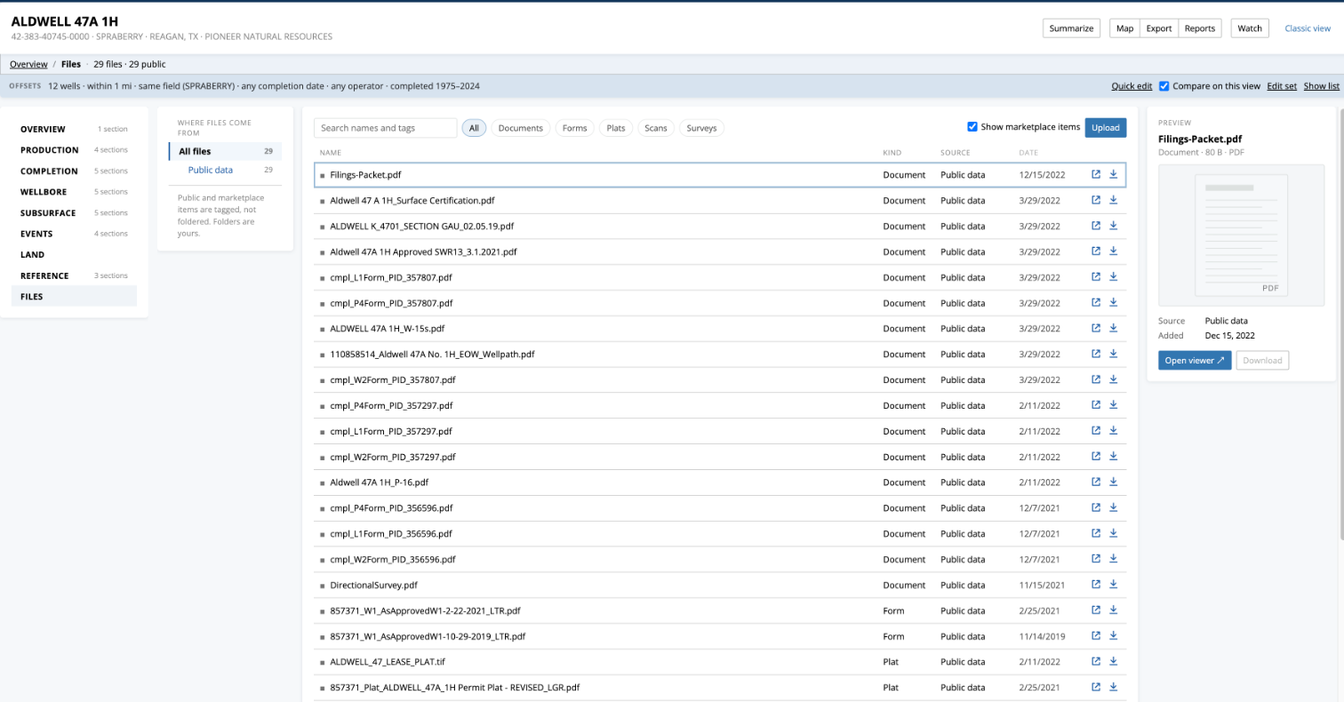
Files lists the well's publicly available documents, such as TIFF, PDF and LAS files, together with your own files on the well.
- Where files come from on the left filters the list by source.
- Search names and tags, or filter by kind (for example logs, plats or surveys).
- Select a file to preview it. Open viewer ↗ opens it in the built-in viewer, and Download saves it.
- Upload adds your own file to the well.
Viewing and downloading documents requires a paid plan, and access to file-viewing tools varies by plan. For example, the built-in LAS Viewer is available with Plus and Pro plans.
For more information, see Download files from a single well, Download files in bulk from multiple wells, Download files using an API request and Viewing documents in WellDatabase.
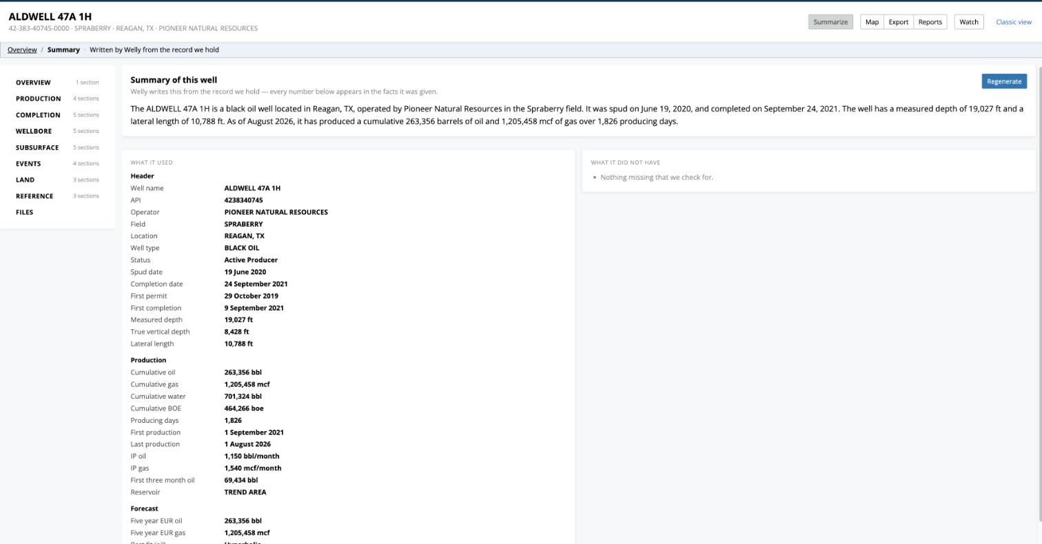
Summarize
Click Summarize in the header and Welly writes a summary of the well from the record WellDatabase holds. Every number in the summary appears in the facts listed beside it under What it used, and What it did not have lists anything that was missing. Click Regenerate for a fresh summary.
Summarize uses Welly. If Welly isn't enabled for your account, the page says so.
The Classic Page
The classic well detail page shows the same records in tabs, such as General, Production, Permits, Completions, Casing and Files. You'll see it when:
- You're on the Lite plan.
- You click Classic view at the top right of Well Details, which opens the classic page for that well.
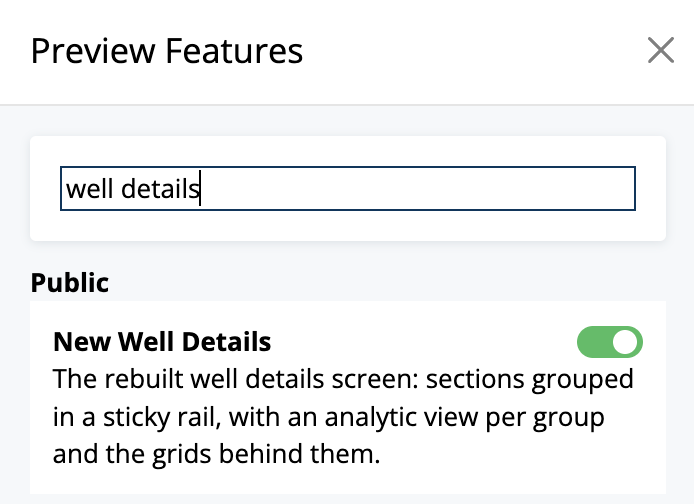
- You've turned the new page off. To use the classic page everywhere, open the account menu at the top right of any page, select Preview Features, and turn New Well Details off. It stays off until you turn it back on. When you turn it off, you can optionally say why.
List View
Paid plans can also view record types for many wells at once from the List. Use the Show dropdown to change from the default Headers view to another record type, such as completions, casing or disposition records. Lite users can view the default Headers list. For more information, see What can I do with a list?
Subscription Requirements
Access to Well Details depends on your WellDatabase plan:
- Lite (free): View up to 50 unique well detail cards each month, on the classic view only. Available views reset monthly.
- Essential: Unlimited well detail views on the Well Details page.
- Plus: Unlimited well detail views on the Well Details page.
- Pro: Unlimited well detail views on the Well Details page.
Once a Lite user reaches the monthly limit, the "Well Detail Views are currently unavailable" message appears when attempting to open another well detail card.
Access to specific data, tools and functionality within Well Details varies by plan. For example, the Gun Barrel Plot tool and the LAS Viewer are available with Plus and Pro plans. See Compare Plans for current feature availability.
Related Articles
- What data is included in Header records?
- What can I do on the production charts?
- How do I create a decline curve on a single well?
- How do I create a Gun Barrel Plot?
- How do I watch a well in WellDatabase?
- How do I download a file?
- Can I add my own searchable user data to a well?
- What features are included with Lite plan?
Frequently Asked Questions
Q: Why does the well detail page look different?
A: Since November 10, 2026, paid plans open wells on the new Well Details page, which groups everything on a well into one page with a rail of views. It shows the same records as the classic page.
Q: How do I go back to the classic page, or back to the new one?
A: For one well, click Classic view at the top right of the page. To switch everywhere, open the account menu, select Preview Features, and turn New Well Details off or back on. A change can take up to five minutes to take effect.
Q: Where did the General and Files tabs go?
A: The well's header record (General) is at the bottom of Overview; you can also select General under Overview in the rail. Files is the last group in the rail.
Q: Why aren't all of the offsets shown in the completion design space?
A: A well needs both a volume and a footage to be placed on the chart. Offsets whose completion records lack either are left off, and the chart says how many it could place.
Q: Why does the wellbore schematic say a cement top is estimated?
A: When a casing record has cement sacks but no reported cement top, the schematic estimates the top and labels it "est." Reported tops are drawn as reported.
Q: Someone sent me a link to a well, and I see an Upgrade Required page. Why?
A: Links to the new Well Details page require a paid plan. On the Lite plan, open the well from the map or the list instead, and it opens on the classic page.
Q: Why am I receiving an error message that says "Well Detail Views are currently unavailable"?
A: This message appears when a Lite user has reached the monthly limit of 50 unique well detail cards. Opening the same well again in the same monthly cycle doesn't count as another card. Available views reset monthly, or you can upgrade to a paid plan for unlimited well detail views.
Q: Why don't I see data in every section for every well?
A: Available data varies by well, based on the records available from the source. Every view reads the same records as the classic page, so a section that is empty on one is empty on the other. Access to certain data types and tools may also depend on your plan.
Explore additional articles by searching the topics on the left. If you have any questions, feel free to email support@welldatabase.com