To get started, utilize the filters to refine your search results based on the specific well spots that pique your interest. Once you have narrowed down your selection to align with your plan export limitations, simply click on "export all" from the list to access the data export wizard.
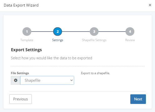
In the file settings, choose Shapefile as your export format.
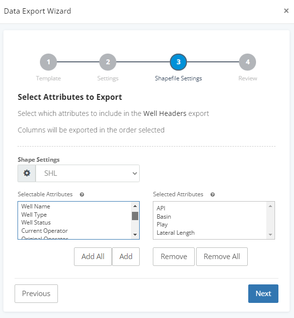
Shapefile Settings
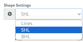
Choose the well spot you would like to export:
-
-
-
- Lines - Connection between surface and bottom
- SHL - Surface hole
- BHL - Bottom hole
-
-
If you wish to export all the shapes, you will need to run three separate exports because they will be saved in separate shapefiles.
Attributes
Next, select the attributes that you want to be associated with each well spot.
Lastly, provide a name for your file and then click the "finish" button. Once you have initiated the export process, you can monitor the progress of the export by checking the "My> Exports" in the ribbon along the top of the screen.