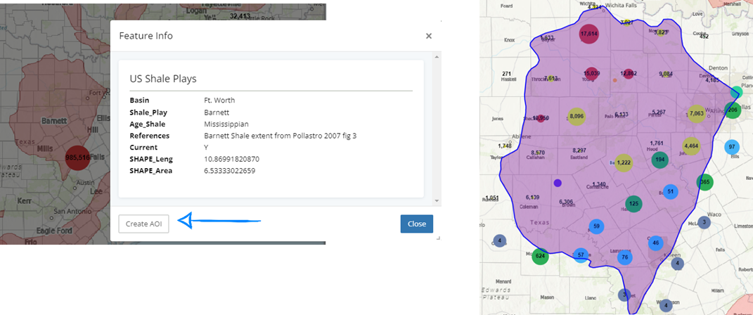
Using interactive layers is an easy way to create custom areas of interest within a map.
Best Practice Tip:
Only have one layer interactive at a time.
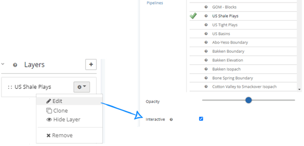
Activating an existing layer
From Map tools, navigate to Layers > Left Click  > Edit> mark Interactive> Load
Clicking on a shape boundary on the map will allow the option to create an AOI and limit the search filters to this area.
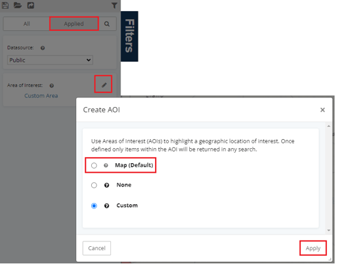
Remove the Area of Interest Filter
Select the applied filters, then click  to change the area of interest back to either map bounds or none.