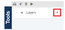
To get started, open Tools panel, click the + button in the Layers section
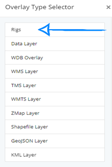
Then select Rigs from the overlay type selector
There are a number of settings you can configure. The Settings menu lets you specify a name, layer opacity, whether you want the layer to be interactive (where you can click on the spots), and finally, the period for the rigs you want to show. This can be current rigs or the rigs in the past 30/60/90 days.
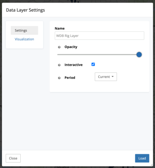
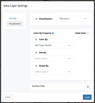
This Visualization menu gives you multiple options to visualize the rigs. These are the same options you will find in your Map Tools settings.
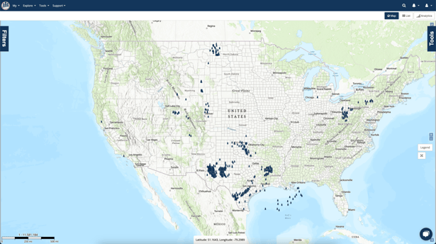
Once Rigs have been added as a data layer, the current rig locations across the US will show up throughout the map.