![WellDatabase-Rect-1000x159-1.png]](https://support.welldatabase.com/hs-fs/hubfs/WellDatabase-Rect-1000x159-1.png?height=40&name=WellDatabase-Rect-1000x159-1.png)
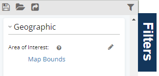
Map Bounds is the default Area of Interest (AOI) when opening the map, making it one of the quickest ways to begin exploring data. You can simply zoom to the area you want to analyze, and WellDatabase automatically limits your list and analytics to the wells currently visible on the map.
The example below shows Map Bounds being used as the only geographic filter. With only Map Bounds applied, the Analytics tab summarizes the wells currently visible within the map extent. In this example, the analytics are calculated using more than 5 million wells. 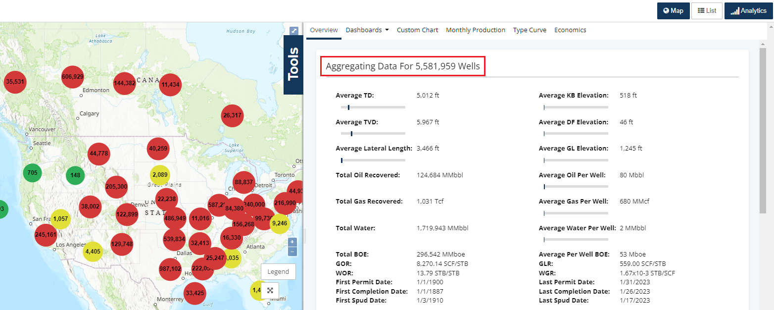
Now zoom in to a smaller geographic area. As the visible map extent becomes smaller, Map Bounds automatically updates the Area of Interest and recalculates the analytics using only the wells currently displayed on the map. 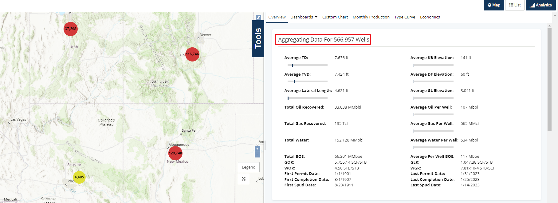
Note: Map Bounds uses the visible map extent—not state boundaries—to define the Area of Interest. Because the current map view extends beyond New Mexico, wells from neighboring states are also included in the analytics. As a result, the analytics summarize approximately 195,000 wells, even though the clustered well count displayed for New Mexico is about 129,000 in the previous screenshot.
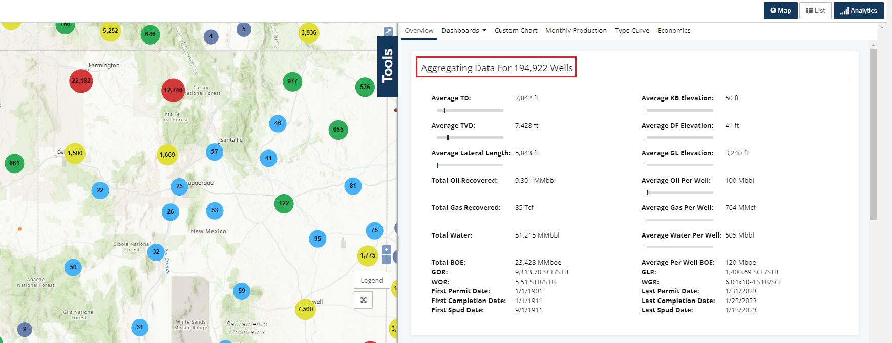
As you continue zooming in toward Carlsbad, the map transitions from clustered well counts to individual well spots. This occurs automatically once fewer than 50,000 wells are visible within the current map extent.
Tip: The map automatically switches from clustered well counts to individual well spots when fewer than 50,000 wells are visible. This makes it easier to inspect wells as you continue zooming into an area. 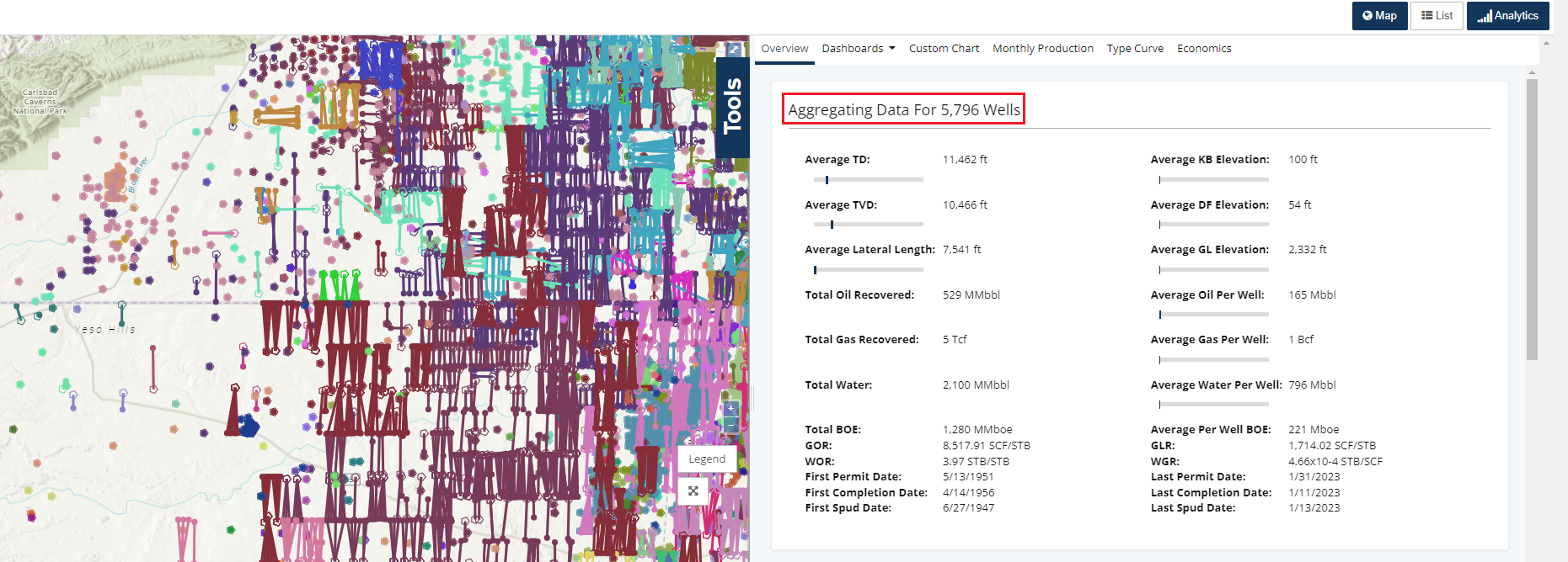
Using Map Bounds with Search Filters
Map Bounds works together with any search filters you apply. When additional filters are added, the visible map remains the Area of Interest while the search results are refined to match your selected criteria.
In this example, a Lease filter is added to the current search. Since our screenshot has Apply Current Filters selected, only leases in this visual area of the map will appear.
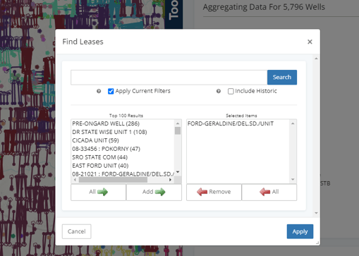
After clicking Apply, the map updates to display only the wells that match the selected lease within the current search. The Analytics are also recalculated using only those matching wells.
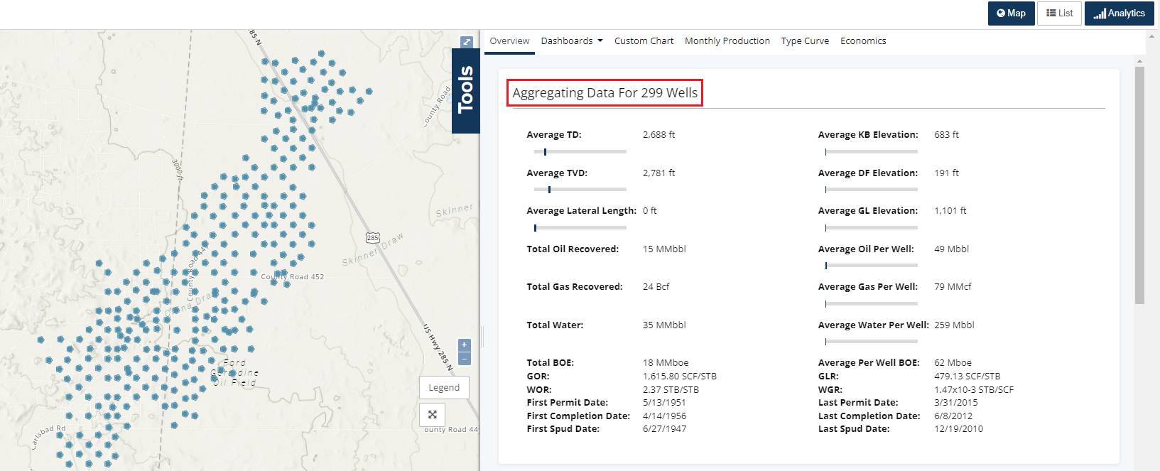
The map, list, and analytics remain synchronized, making it easy to continue refining your search without creating a separate Area of Interest.
Controlling Map Movement After a Search
If your map zooms all the way out to a North America-wide view—or changes location every time you click Search, or enter a new filter —the Zoom to Results option is likely enabled.
Map Bounds determines which wells are included in your search based on the visible map extent. It does not control whether the map automatically changes location after a search.
To keep the map centered on your current working area while refining your search:
-
Click the arrow next to the Search button at the bottom of the filters section to display the search options.
-
Uncheck Zoom to Results.
-
Click the arrow again to close the search options. Your preference is saved automatically.
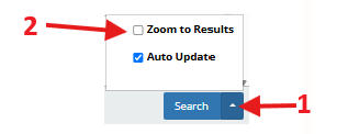
Tip: Zoom to Results is helpful when you want the map to automatically display every well returned by a new search. If you're repeatedly adding filters while working in the same geographic area, turn this option off to keep the map centered on your current location. Your preference is saved until you change it again.
Related Articles
Frequently Asked Questions
Q: Why does my map zoom all the way out to a North America-wide view after I search?
A: This usually means Zoom to Results is enabled. When enabled, the map automatically pans and zooms to display all wells returned by your search. If you want to remain focused on your current work area while adding filters, uncheck Zoom to Results and leave Map Bounds enabled.
Q: Does Map Bounds automatically update analytics?
A: Yes. As you pan or zoom the map, Map Bounds automatically updates the Area of Interest. The Map, List, and Analytics tabs refresh using the wells currently visible within the map extent.
Q: Can I use Map Bounds together with other search filters?
A: Yes. Map Bounds works alongside all other search filters. As you add filters, the visible map remains your Area of Interest while the search results and analytics update to reflect both the current map extent and your selected search criteria.
Explore additional articles by searching the topics on the left. If you have any questions, feel free to email support@welldatabase.com