How do I print a WellDatabase map?
How to use the WellDatabase Print Tool to Generate a PDF or Image
Overview
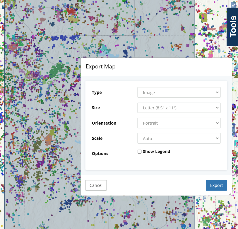
The WellDatabase Print Tool allows you to export your map to an image, or PDF. Any layers you have loaded, and the current wells spots will be included in the generated file. The Print Tool also allows you to print the map to a specific scale, and optionally show or hide a legend on the print.
Opening the Print Tool
1. Expand the Map Tools Pane, and click the Printer icon.

2. The Print Tool along with a blue bounding box will be visible on the map.
You may need to adjust the scale, or move the Print Settings dialog to see the blue map preview bounding box.

3. At this point you can pan the map, and adjust the print settings in the dialog to align the preview box with the area you would like included in the map print.
4. When done, click the ![]() button to generate your print. After a short wait, your print should automatically download.
button to generate your print. After a short wait, your print should automatically download.
Print Settings
The Print Tools offers a variety of settings to configure your print.
When the Print Tool is opened, a blue box is displayed on the map to show which area of the map will be visible in the final print.
Type
The type of the print, choose between PDF and image. Image exports will be generated as PNGs. PDFs have a margin automatically applied to prevent shrinking the scale when printed. Image prints will be borderless, like normal image.
Scale
Allows you to print the map to a different scale than the current map. The preview box on the map will increase and decrease in size as you change this value. In general, the larger the second number is, the more zoomed out the print will be.
Size
The size of the PDF or image generated. The preview box on the map will increase and decrease in size as you change this value.
Orientation
The orientation of the selected print size. Portrait will be longer top to bottom, than it is side to side. Landscape will be larger side to side than it is top to bottom. The preview box on the map will increase and decrease in size as you change this value.
Show Legend
Whether or not to render the legend on the generated print. The preview box on the map will increase and decrease in size as you change this value.